Airborne geophysical prospecting, referred to as airborne geophysics for short, is an advanced technology that combines geophysical exploration techniques with aviation technology. It involves using aircraft or other flying platforms equipped with specialized geophysical instruments to detect variations in various physical fields of the Earth (such as magnetic, gravitational, and conductivity fields) during flight, thereby studying and locating subsurface geological structures and mineral resources. The main survey techniques currently include Aeromagnetic Gradient, Airborne Electromagnetic, Airborne Gravity, and Airborne Gamma‑ray Spectrometry Surveying.
Our company provides services such as flight support and data acquisition for various projects, and has successfully completed multiple engineering projects.
► Application Advantages
(1) High speed and high efficiency, enabling rapid coverage of large areas within a short period;
(2) Not constrained by geographic, topographic, or climatic conditions;
(3) Relatively uniform survey precision over large areas, and capable of operating in regions with difficult terrain conditions.
► Engineering Case
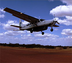
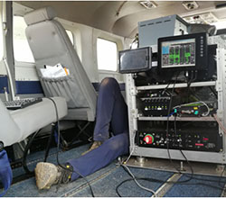
Aerial Gravity & Magnetic Data Acquisition Aerial Gravity & Magnetic Measurement System

